Mitigation
 The Water Department plays a crucial role in overseeing the progress of LADWP’s environmental and mitigation projects in the Owens Valley. These projects are described in the 1991 EIR regarding LADWP’s groundwater pumping in the Owens Valley, the 1997 MOU, and subsequent documents prepared and approved by the Inyo/LADWP Technical Group. Under the Inyo/Los Angeles Water Agreement and the 1991 EIR concerning LADWP’s groundwater pumping in the Owens Valley, the Inyo/LA Technical Group must prepare annual status reports on the EIR’s mitigation measures, on mitigation measures subsequently adopted by the Inyo/LA Standing Committee, and on Enhancement/Mitigation projects. The Water Department has prepared a series of tables which summarize the status of the mitigation measures adopted at the time the 1991 EIR was approved. The tables are intended for use by the Technical Group in preparing the annual status reports.
Interactive Mitigation Map (beta)
This map offers a comprehensive overview of all Owens Valley mitigation projects tied to the Long-Term Water Agreement, Stipulations and Orders, and subsequent initiatives. Serving as a complement to the Mitigation Status Table, the map is a valuable resource for both newcomers and those familiar with the projects. Users can explore the geographic distribution, view project site photos, and easily find specific projects through filters. Clicking on a project’s centroid point provides detailed information, including origin, impact, status, and available water delivery details. An additional information library offers downloadable files related to the project.
Mitigation Status Table
Status of the enhancement/mitigation projects from the 1991 EIR and Other Inyo/LA Standing Committee-Approved Initiatives. This table, developed in partnership between LADWP and Inyo County, reflects the collective perspective of both agencies on the current status of these projects.
 Ad Hoc Projects
In February 2006, an Ad Hoc Group consisting of representatives from the Parties and ranching interests met to discuss alternatives to the draft plans. The Ad Hoc Group operated with a consensus-based approach as a means of recognizing all parties’ interests. The Ad Hoc Group met on a regular basis, and developed and, in November 2008, agreed on a set of projects that they believe would fulfill the commitment in the MOU that LADWP provide 1,600 acre-feet of water per year for the Hines Spring mitigation measure and additional mitigation.![]()
 Specific Mitigation Measures
- Lower Owens River Project (LORP) – The Lower Owens River is located in the southern Owens Valley. An approximately 60-mile reach of the Lower Owens River was diverted to the Los Angeles Aqueduct in 1913 to supply water to the city. DWP is required to re-water this dry section of the river.
Grants
IRWMG Recycled Water for Restoration and Community Projects in Big Pine
1999 Revegetation Plan
Irrigation In the Laws Area MND (2003)
Saltcedar Control – The Saltcedar Program is responsible for controlling all saltcedar, a non-native invasive species, on LADWP lands within the Owens Valley.
Spring & Seep Inventory – Owens Valley Spring and Seep Inventory, D. Sada and D. Herbst; an MOU requirement. (2001)
Independence Regreening Project – Independence Regreening Project Negative Declaration, prepared by LADWP (2004)
Big Pine Northeast Regreening Project ![]() – Big Pine Northeast Regreening Project Negative Declaration, prepared by LADWP (2011)
– Big Pine Northeast Regreening Project Negative Declaration, prepared by LADWP (2011)
Vegetation Parcel Blackrock 94
The Water Agreement provides for ongoing monitoring of conditions in Owens Valley, and mitigation of any impacts that occur due to LADWP’s groundwater pumping or changes in surface water management. If a significant impact occurs, the Technical Group must prepare a mitigation plan. Vegetation parcel Blackrock 94 is a 333 acre parcel of alkali meadow vegetation located in the Thibaut-Sawmill well field, southwest of Black Rock Fish Hatchery. The Technical Group considered evidence submitted by the County concerning conditions in the parcel, but was not able to reach agreement as to whether a mitigation plan should be prepared. The County submitted the issue to dispute resolution, and a mediation/arbitration panel was convened to resolve the dispute. On October 21, 2013, the arbitration panel issued findings and partial interim award. This Fact Sheet summarizes the dispute, findings by the panel, and next steps.
Briefs by the parties:
Inyo Initial Brief (7/26/2013)
LADWP Initial Brief (7/26/2013)
Inyo Response Brief (9/3/2013)
LADWP Response Brief (9/3/2013)
Additional Resources
- ICWD Site Assessment of Five Bridges Impact Area
- Appendix A
- Appendix B
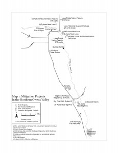
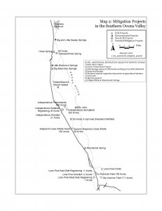
- Mitigation Measure Maps: Northern and Southern Owens Valley

- Area Maps of Selected Mitigation Measures

- Yellow-billed Cuckoo Habitat Enhancement Plans (Nov 2009)
- Potential new Enhancement/Mitigation Projects (2018)
- 2001-Annual-Monitoring-Report-for-the-Mitigation-Monitoring-Program.pdf (inyowater.org)
