Groundwater Monitoring
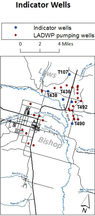
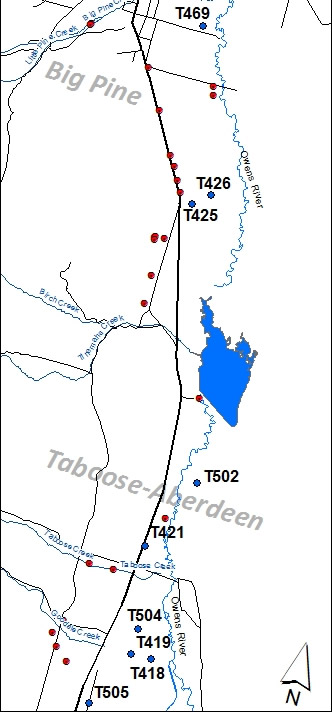
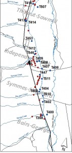
Indicator wells are shallow groundwater monitoring wells located in wellfields that have a relatively long period of record that have been chosen to indicate changes in groundwater levels as a result of LADWP pumping and runoff conditions. The ICWD uses empirical models for most of these wells to predict annual changes in water levels based on LADWP pumping in the wellfield and Owens Valley runoff amounts. Each April, ICWD hydrology staff measure water levels in these wells. At other times of the year, the wells are monitored by LADWP.
Maps of the indicator well and LADWP pumping locations are provided below. Recent measurements are included in the 2019 indicator wells table and hydrographs for each well. Hydrographs are also provided for Bishop and Lone Pine wellfields. These are not indicator wells and all data were collected by LADWP.
Indicator Wells
Wellfield Hydrographs