Water Department
ICWD Home > Research and Reports > Annual Reports >
Table of Contents
Cover Page
Director's Report
Staff
Budget
Saltcedar Report
Precipitation
Mitigation
Vegetation
Soil Water Conditions
Groundwater Conditions
LORP Hydrology
Pumping History
Pumping 2008-2009
Bishop Cone Audit
Shallow Groundwater Adjacent to the Lower Owens River
Base flows of 40 cubic feet per second were established in the Lower Owens River in the 2007-2008 runoff-year. As of this date two habitat flows have also been released down the Owens River channel.
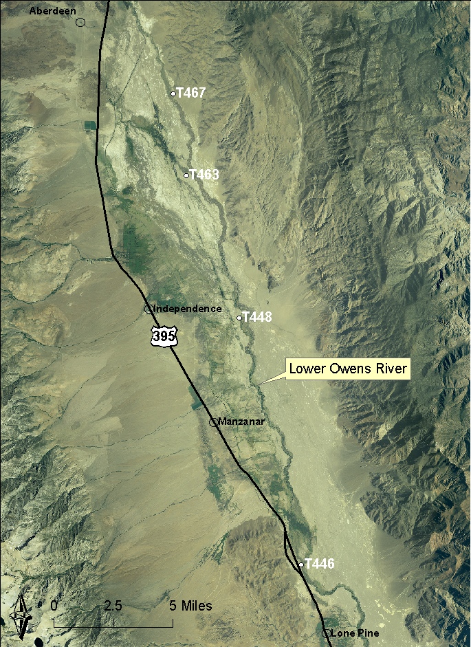
Shallow test holes adjacent to the Lower Owens River have been monitored by LADWP while base flows were established. A selected number of these test holes are listed in Table 4 along with the distance the test hole is located from the Lower Owens River channel. The test holes are identified as being in a wet reach or dry reach before the rewatering of the Lower Owens River Project took place. A map showing the locations of these test holes is provided below.
Table 4. Selected Shallow Test Holes Adjacent to the Lower Owens River Project.
| Test Hole Number | Distance from the River Channel |
| T467 (Dry Reach) | 700 feet |
| T463 (Dry Reach) | 1070 feet |
| T448 (Wet Reach) | 457 feet |
| T446 (Wet Reach) | 142 feet |
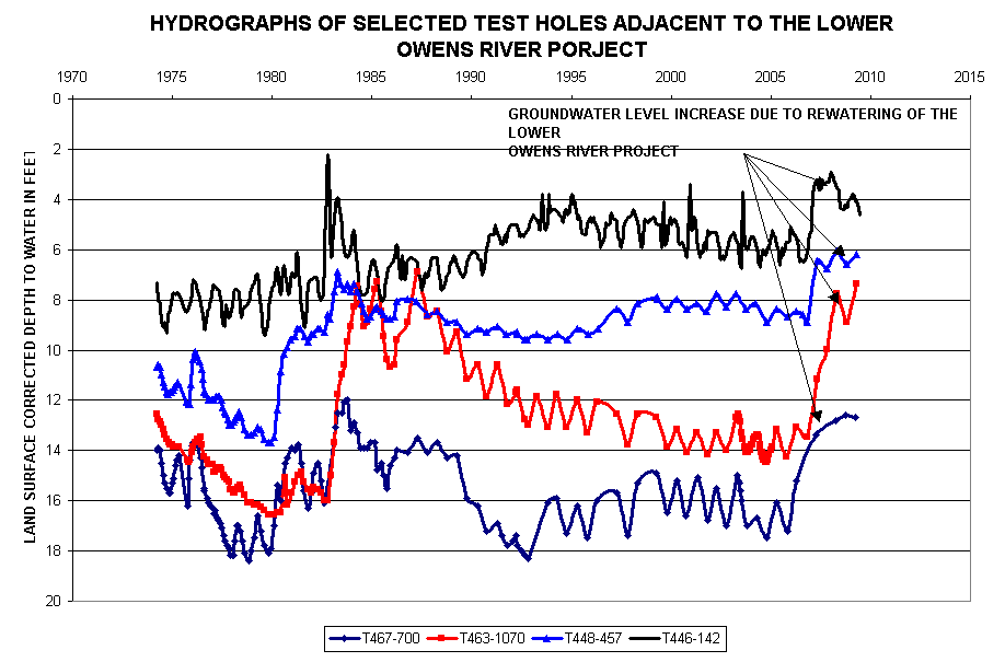
A composite hydrograph of these test holes for the period of record is shown in this composite hydrograph. Shallow groundwater levels increased in response to the increase in stage associated with the establishment of base flows in the Lower Owens River where the channel was previously dry and wet. The magnitude of the increase can be read from the composite hydrograph.