Hydrology
LADWP collects the majority of hydrologic data in the Owens Valley. Through the provisions of the Water Agreement, these data are made available to Inyo County and are transferred to the Water Department each year. LADWP collects data on pumping amounts from approximately 100 pump-equipped wells as well as groundwater level data from hundreds of deep and shallow observation wells. LADWP also maintains a large network of surface water monitoring stations. A hydrograph of the 2023 Bishop Creek Flows can be found here. Selected surface water data pertaining to the Los Angeles Aqueduct system are provided as provisional real time data on their website. Provisional data are subject to revision during LADWP internal quality control/quality assurance process.
The Inyo County Water Department collects data from selected monitoring wells associated with vegetation monitoring site (monthly) and other indicator wells annually to assist evaluation of LADWP operations plans. Those data are provided on the following pages.
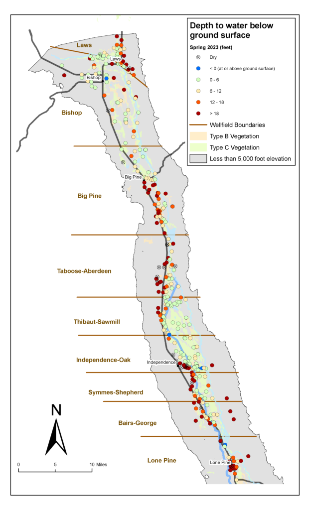
In late March or early April ICWD staff have collected depth-to-water measurements from a suite of several hundred test wells. The figure below spatially displays water levels from March/April in feet below the ground surface.